

281
Abraham Ortelius
Theatrum orbis terrarum, 2015-2018.
Schätzung:
€ 1.500 Ergebnis:
€ 1.625 (inkl. Käuferaufgeld)
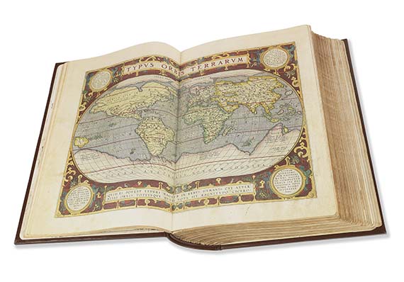
Abraham Ortelius
Theatrum orbis terrarum. Faksimile der Exemplare BG-52039 der Universität Salamanca und C.F.4 der Bibliothek der Bilbao-Gesellschaft. Salamanca, Ediciones de Arte y Bibliofilia 2015-2018.
Faksimile der beiden herausragend kolorierten Exemplare des Ortelius-Atlas aus der Universitätsbibliothek in Salamanca und der Bibliothek der Bilbao-Gesellschaft.
1 von 375 numerierten Exemplaren. Mit Kommentarband von A. Hernando.
EINBAND: Orig.-Lederband mit etw. Blindprägung und Rückenschild sowie Metall-Eigner-Schild im Innendeckel, in illustr. Orig.-Leinen-Schuber. 44,5 : 29,5 cm.
1 of 375 numb. copies. Orig. blindstamped calf with gilt label on spine and owner's metal-label on front pastedown, in orig. cloth case with cover illustrations.

281
Abraham Ortelius
Theatrum orbis terrarum, 2015-2018.
Schätzung:
€ 1.500 Ergebnis:
€ 1.625 (inkl. Käuferaufgeld)

Ihre Lieblingskünstler im Blick!
- Neue Angebote sofort per E-Mail erhalten
- Exklusive Informationen zu kommenden Auktionen und Veranstaltungen
- Kostenlos und unverbindlich